Range of Circumstances in Italy


Introduction

Considering the hydrologic status of Italy, the country shows extremely variable situations. In the North of Italy there are wide basins supplied by the Alps and characterised by high water flow; on the contrary, along the Apennine range, watercourses have a narrower basin and a more irregular course.  There are a few tens of watercourses longer than 100 km, among which the Po River is the longest with 652 Km. Italy is fairly well supplied with lakes, having several thousand natural and artificial basins of different sizes and origins. The mean yearly precipitation in Italy is estimated in 300 billion m3, that is 990 mm, greater than the European mean value of 646 mm. Rainfall distribution varies from the highest quantities of 3,000 mm on the Alps and the Apennines to 600 mm in the southern regions, resulting in the following percentages of annual precipitation: 41% in the North, 22% in the Centre, 24% in the South and 13% in the Islands. 

The total usable surface water at the country level, considering rivers and lakes, can be estimated around 39.7 km3 whereas groundwater is about 12 km3. In respect to the actual population, the annual available resource varies from 388 m3/person (Sicily) to 1,975 m3/person (North East zones).


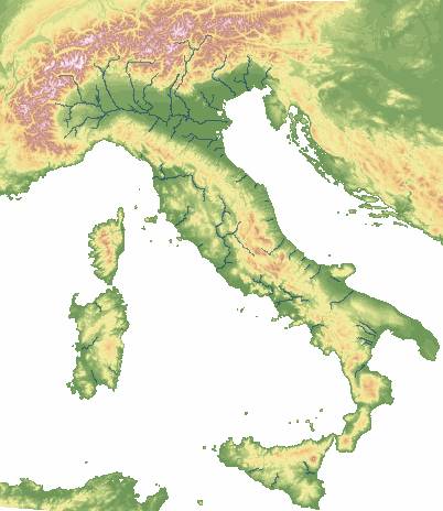
Overview of the Country


Water Demand and Supply Status


According to standard parameters such as the annual average flow rate, Italy should be placed among the countries rich in water resources, the theoretical annual available resource being of 155 km³, that is 2700 m³/person. Nevertheless, considering the potentially usable resources, the irregularity of flows and the practical difficulties of using many "theoretically" available resources, such availability lowers considerably to 110 km³ (2000 m³/person.). If we consider, instead, only the actual usable resources, the availability datum drops to 42 km³, that is 928 m³/person. 

The regions of the North rely on the abundance of groundwater and surface water resources also thanks to the morphology permitting the natural storing capabilities of lakes and glaciers. Artificial control of flow in rivers and from reservoirs guarantees a potentially usable surface water two times and a half higher and an almost regular availability. The availability of water resources in the South of Italy is much more reduced. In Southern regions such as Puglia, Sicily and Sardinia, atmospheric precipitation is 40-50% less than in the most rainy regions of Italy. Besides, percentage of available resources that are usable drops remarkably from 50% in the North to the 15-20% in Sicily and Sardinia, and even 10% in Puglia. Total annual available groundwater is about 12-13 km³, that is about 200m³/person, but groundwater resources are distributed in a very irregular way, 70% being located in the alluvial plains of the Northern regions, particularly in the Po River Basin. The usable aquifers in the South of Italy are mainly limited to the few coastal plain areas and to inland zones. 

Groundwater represents the main supplying source for civil uses, above all in the North of Italy, where 90 % of water supply comes from deep aquifers and springs. In the South and in the islands, surface reservoirs are a very important water source and provide about 15-25% of the total supply. Deep aquifers provide also the greatest supply of water for industrial uses, particularly in the North. Surface water withdrawals are almost exclusively carried out for energy consumption, while a certain amount, rather difficult to estimate, is provided to industries by the network of land-reclamation syndicates.  

The quantity of water used by Italian industries every year has been estimated to be around 8 km³, getting the total amount of 30 km³ if we consider about 23 km³ of water used to cool thermoelectric plants. Total amount of yearly withdrawals of fresh water for industrial and energy purposes is about 12-13 km³. Seawater is the most used with for cooling operations (about 75% of the requirements).


Environment and protection


As far as water quality is concerned, Italy shows a rather variable situation because of its morphology and hydrologic characteristics. In the North, bacteriological and organic problems mostly involve minor watercourses that are placed in the nearby of urban areas. They affect main watercourses, such as Piave and Tagliamento, only occasionally and during periods of minimum flow.

The Northern area of the Adriatic Sea is affected by eutrophication: on one side many rivers carry nutritious substances and on the other the dilution of the inflows is not helped by the inland, shallow and lagoons-featured nature of the sea. In the last years alga and mucilage proliferation has no more occurred but in the nearby of transition ecosystems (Venice and Marano lagoons, Po delta, damp inland areas), the status of the area is still critical.

In the last decades a worrying deterioration of the aquifers has occurred, above all owing to the presence of organochlorinated compounds and heavy metals in the metropolitan area of Turin, in the neighbouring area of Milan, and in the piedmont area of Veneto region. Nitrates are found in particular in northern flat areas, especially in Lombardia region and along the Via Emilia.  

In Central Italy, the conditions of main rivers such as Tevere and Arno are strongly affected by the seasonal variability of flow rate. Arno has to face the pollution of bacteriological and organic agents caused by the massive pressure of urban areas along the course and by the presence of industrial sites around Florence and Prato. Tevere shows acute pollution only in upstream-localised reaches, where the flow rate is low and the neighbouring cities discharge untreated wastewater. The degree of pollution increases in the metropolitan area of Rome. 

In the South of Italy the trophic quality of artificial reservoirs used to store drinking water is crucial. Causing factors are farm pollution as well as drainage of rainfall waters coming in contact with polluted ground. Deep aquifers, in particular along the coastal plain areas, have to face the pollution of fertilisers, toxic substances coming from vacant industrial sites and the shedding of wastewater on the ground.


Institutional framework and constraints


During the past 15-20 years Italian legislation has been redirected with a decentralisation of rights and authority of the state towards regional and local management, resulting in the re-organisation of roles and duties in an attempt to overcome the breakdown of management and to encourage the co-ordination of agencies.

The administration and management of water resources is divided into the three levels of state, regional and local. The State, through the Ministry of Environment and of Territorial Protection and the National Agency For Environmental Protection, is responsible for the formulation and regulation of laws, establishing technical standards, co-ordinating research and monitoring/observation. The regions are concerned with the planning and administration of resources through the Regional Agencies For Environment Protection, councils, technical services and the eventual co-ordination with the Basin Authority. On a local level, there are various associations for re-adaptation, treatment and provisions of water. They include towns, districts, mountain communities, the re-adaptation syndicates and other public associations and institutions of public rights with headquarters in the hydrographical basins. In agreement with the established law 36/94, the action of local groups is required to be co-ordinated and finalised with an integrated management of water services, through the authority of Ambito Territoriale Ottimale. The Basin Authorities are national, regional or inter-regional and are responsible for: identifying and measuring actual and potential degradation of the physical systems, preparing directives for hydrogeology and hydraulics and for the utilisation of waters and soils, planning and utilising water, agricultural, forestry and mining resources.


Management, Institutional and policy options


Insufficiency of civil water supply affects in particular Southern Italy (Calabria, Puglia and Sicilia regions) while in Northern and Central Italy the water consumptions are pretty constant or show a negative trend. Moreover, water demand can increase locally due to tourist pressure, for example along Liguria and the Adriatic coasts.

Some critical factors at the local level are population growth, pollutant loads in shallow aquifers and insufficient maintenance of the water distribution network. Policy options adopted concern: development of new water sources, water transfers, use of new technologies in treatment plants and specific measures aiming at controlling the distribution losses and in general to reduce the demand. 

The 40% of the agricultural production and the 60% of the agricultural export of Italy depend on irrigation. Irrigation is also of primary importance for the Italian agricultural landscape that would otherwise present some desert areas. Although agriculture represents the greatest water consumer at the national level (50-60% of the total), the water requirements of areas that can be potentially irrigated are not completely covered. The repeated droughts of the last ten years have engraved on the estimated availability.

Policy options involved are: use of non-conventional sources, improvement of the efficiency of distribution networks and of treatment systems, higher priority of irrigation over the industrial user.  

The water consumptions for industrial use in Northern Italy have been progressively diminishing in the recent years, first of all due to application of technologies requiring ever less water. There are not deficit conditions but at a local level the pressure on resources due to over-exploitation is getting almost unsustainable. In Southern Italy the past years were characterised by a policy of industrial development supported by construction of the necessary supply systems, while currently the expansion of industrial sectors keeps the focus on valorisation of existing resources.


Range of Circumstances in Emilia-Romagna Region


The climate of Emilia-Romagna has sub-continental characteristics, with cold winters and hot summers, moderated, however, by sea breezes along the Adriatic, while the temperatures are closely affected by altitude in the Apennine region. Rainfall is about 800 mm/year whereas evapotranspiration is about 500 mm. With regards to population distribution, two zones are easily distinguished: the hills and mountains, thinly populated and less suitable for economic exploitation, and the plains, characterised by an excellent communication network, intensive farming and ideal conditions for industrial development. 

The daily consumption of water for domestic uses at a regional level is estimated in 158 l/person with a value of 150 l/person*day for the western provinces and over 160 l/person*day for the eastern ones. Part of the surface water used for field irrigation, about 260 hm3, is currently uptaken from the Apennine’s rivers and torrents. However, this amount is going to be dramatically reduced with the future application of the DVM, Minimum Vital Discharge aiming to reach a good environmental quality level of the fluvial ecosystem, in terms of river basin morphology, interactions with aquifers, water quality, hydrology. The reduced availability from hill and mountain basins, about 70 hm3 per year, will be probably covered partly by further 30 hm3 per year abstracted from the aquifers. As the groundwater resources in Emilia-Romagna is already overexploited, these withdrawals will solve a problem but on the other side will worsen the subsidence phenomenon and the intrusion of brackish and marine water along the coasts. 

Quality of watercourses is pretty good at least for the stretches in the Apennine, where drinking use is usually possible without treatment. The use for irrigation is almost always permitted even if the stretches serving the provinces of Ferrara and Rimini have a relevant concentration of chlorides, so requiring a good drainage of the cultivated soil. Generally the river stretches in the plains present qualitative characteristics insufficient to direct drinking use and also to the aquatic life of plants and animals. 

The main problem in groundwater quality consists in the presence of nitrates, mostly in the areas under alluvial cones where their concentration is greater than 50 mg/l, which is the limit for the drinking use. Therefore expensive treatment or mixing with water of better characteristics is needed.

As far as the coastal water quality is concerned, it can be given a “medium” rate. The eutrophication level denotes presence of nutrients and algal biomass associated to low transparent waters and suffering benthic life ecosystem. On the other hand, a study conducted in 1999 on the coastal zones says that bathing and swimming are allowed in the 99.7 % of the controlled coasts so denoting a low presence of urban wasting pollutants. 

The problem of eutrophication is not exclusive to the Adriatic coast but relevant to the entire Po River Basin. A possible solution is coming from the plans of re-use of treated wastewater for irrigation, that the regional and local authorities are studying. Re-use would have the two advantages of nullifying the drainage of treated wastewater into the Po River and reducing the withdrawals of water from aquifers.


Range of Circumstances in Belice Basin - Sicily Region


The Belice Basin is placed in the southwest of Sicily. It covers an area of about 967 km2, in the administrative territory of the Palermo, Trapani and Agrigento provinces. The Belice River is divided into three branches, the Right Branch, the Left Branch and the stretch after the confluence near the town of Poggioreale, each one defining a sub-basin. The Right Branch has a length of 55 km and comes from the Northern part of the Basin. His basin covers an area of 227 km2. The Left Branch has a length of 57 km and comes from Mount Leardo and Mount Rocca Busambra and is supplied by torrents Fosso and Bicchinello. The sub-basin has an area of 407 km2. After the confluence the river extends for 50 km up to the Sicily Canal. 

The mean daily precipitation and evapotranspiration are respectively about 1.256 mm and 3.23 mm; consequently the Aridity Index is 0.39 (semi-arid conditions). The total water resource availability is 80 hm3 of which 24.8 are groundwater. The water sources are the aquifers, 19% of supply, and Belice River together with artificial lakes, 81% of supply. Corleone city takes trans-boundary water from Prizzi Lake in the amount of 18 l/sec which corresponds to about 0.56 hm3/year. About 21.9 hm3/year are transferred towards near basins. Groundwater is used mainly as drinking water for civil municipalities with the 45% of the total, while the 30 % is used for irrigation and the 25% for industrial use.  

Water consumed for irrigation is the 64 % of the total, thus reflecting the fact that agriculture is at the basis of the local economy. Water consumed for domestic use is about 27%, tourists’ consumptions included, and industrial and energy production is 9%. 

The Belice Basin extends under the administrative competence of Consortium n°3 Agrigento. In his territory the lack of water for irrigation in 2001, mainly due to the lower precipitation, caused a heavy delay of the irrigation season from the usual and official starting month of April to the month of June. Besides, the fields’ requirements of the entire region have not been completely covered due to the uneven water availability conditions in the water reservoirs; as a result, the irrigation season has terminated one month before for some districts. Natural conditions are not the only problem affecting the fields water needs: in some districts the absence of the necessary activity of maintenance of the pipelines bringing water from the reservoirs has been the first cause of pipe bursts.


Emilia-Romagna Matrix

INDICATORS

INDEX

VALUE

DATA TYPE

Natural conditions and infrastructure

Regional Context

Climate type

Sub-Continental

Qualitative


Aridity index

1.6

Number


Permanent population

3,924,456

Number

Inhabitants

Area

22123

Number

km2

Water Availability

Total water resources / availability

1925

Number

hm3

Trans-boundary water

0  ( No )

Number

hm3/year

Water quality

Quality of surface water

Medium

Qualitative

Low, medium, good, excellent

Quality of groundwater

Good

Qualitative

Low, medium, good, excellent

Quality of coastal water

Medium

Qualitative

Low, medium, good, excellent

Water supply

Percentage of supply coming from:

§         Groundwater

§         Surface water

§         Desalination, recycling

§         Importing


24 %

76 %

0 ( No )

0 ( No )

Percentage


Network coverage:

§         Domestic

§         Irrigation

§         Sewerage


94.8 %

100 %

71 %

Percentage


Economic and social system

Water use

Water consumption by category:

§         Domestic

§         Tourism

§         Irrigation

§         Industrial and energy production


15 %

included in dom.

32 %

53 %

Percentage


Resources to Population index

720

Number


Water demand

Water demand trends

Stable

Qualitative

Increasing, stable, decreasing

Consumption index

64 %

Percentage


Exploitation index

83 %

Percentage


Pricing system

Average household budget for domestic water (pa)

0.65 %

Percentage


Average household budget for agricultural water

2.5 %

Percentage


Average household income

20228

Number


Cost recovery

Good

Qualitative

Low, medium, good, excellent

Price elasticity

Medium

Qualitative

Low, medium, high

Social capacity building

Public participation in decisions

Average

Qualitative

Good, fair, average, bad

Public education on water conservation issues

Average

Qualitative

Low, medium, good, excellent

Decision making process

Water resource management

Water ownership

Public

Qualitative

private, municipal, regional, national

Decision making level (municipal regional national) regarding:

§         Water supply for each sector

§         Water resources allocation for each sector


Regional –Municipal

Regional -Municipal

Qualitative

municipal, regional, national

Water policy

Local economy basis

Agriculture and Tertiary sector

Qualitative

Tourism, Industry, Services, Agriculture

Development priorities

Demand Management and Waste Water Re-Use

Qualitative

Tourism, Industry, Services, Agriculture

Emilia-Romagna Matrix Notes:  1)  water supply and water use computed from 1997-2000 data and power generation counts for 900 Hm3


Belice Basin ( Sicily ) Matrix

INDICATORS

INDEX

VALUE

DATA TYPE

Natural conditions and infrastructure

Regional Context

Climate type

Warm-Temperate

Qualitative


Aridity index

0.38

Number


Permanent population

55329

Number

Inhabitants

Area

967

Number

km2

Water Availability

Total water resources / availability

80

Number

hm3

Trans-boundary water

0.56

Number

hm3/year

Water quality

Quality of surface water

Good

Qualitative

Low, medium, good, excellent

Quality of groundwater

Good

Qualitative

Low, medium, good, excellent

Quality of coastal water

Good

Qualitative

Low, medium, good, excellent

Water supply

Percentage of supply coming from:

v     Groundwater

v     Surface water

v     Desalination, recycling

v     Importing


19 %

81 %

0 (No)

0 (No)

Percentage


Network coverage:

§         Domestic

§         Irrigation

§         Sewerage


100 %

100 %

100 %

Percentage


Economic and social system

Water use

Water consumption by category:

§         Domestic

§         Tourism

§         Irrigation

§         Industrial and energy production


27 %

included in Dom.

64 %

9 %

Percentage


Resources to Population index

390

Number


Water demand

Water demand trends

Increasing

Qualitative

Increasing, stable, decreasing

Consumption index

100 %

Percentage


Exploitation index

100 %

Percentage


Pricing system

Average household budget for domestic water (pa)

0.47 %

Percentage


Average household budget for agricultural water

5 %

Percentage


Average household income

16740

Number


Cost recovery

Good

Qualitative

Low, medium, good, excellent

Price elasticity

Medium

Qualitative

Low, medium, high

Social capacity building

Public participation in decisions

Bad

Qualitative

Good, fair, average, bad

Public education on water conservation issues

Bad

Qualitative

Low, medium, good, excellent

Decision making process

Water resource management

Water ownership

National ( Public )

Qualitative

private, municipal, regional, national

Decision making level (municipal regional national) regarding:

§         Water supply for each sector

§         Water resources allocation for each sector


Regional

Regional

Qualitative

municipal, regional, national

Water policy

Local economy basis

Agriculture, Tourism

Qualitative

Tourism, Industry, Services, Agriculture

Development priorities

Agriculture, Tourism

Qualitative

Tourism, Industry, Services, Agriculture